Discover Nantucket: A Hand-Drawn Map of the Island’s Iconic Sights
If you’ve ever visited Nantucket or dreamed of exploring its windswept shores, you know this island off Cape Cod has a unique charm. Whether you’re captivated by the cobblestone streets, historic lighthouses, or tranquil beaches, there’s something magical about Nantucket.
I visited there a long time ago as a student. I was working in Boston for the summer on a J1 visa. Some friends spent the entire summer on the island and have wonderful memories.
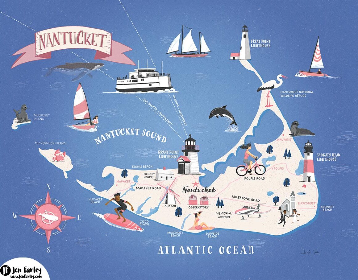
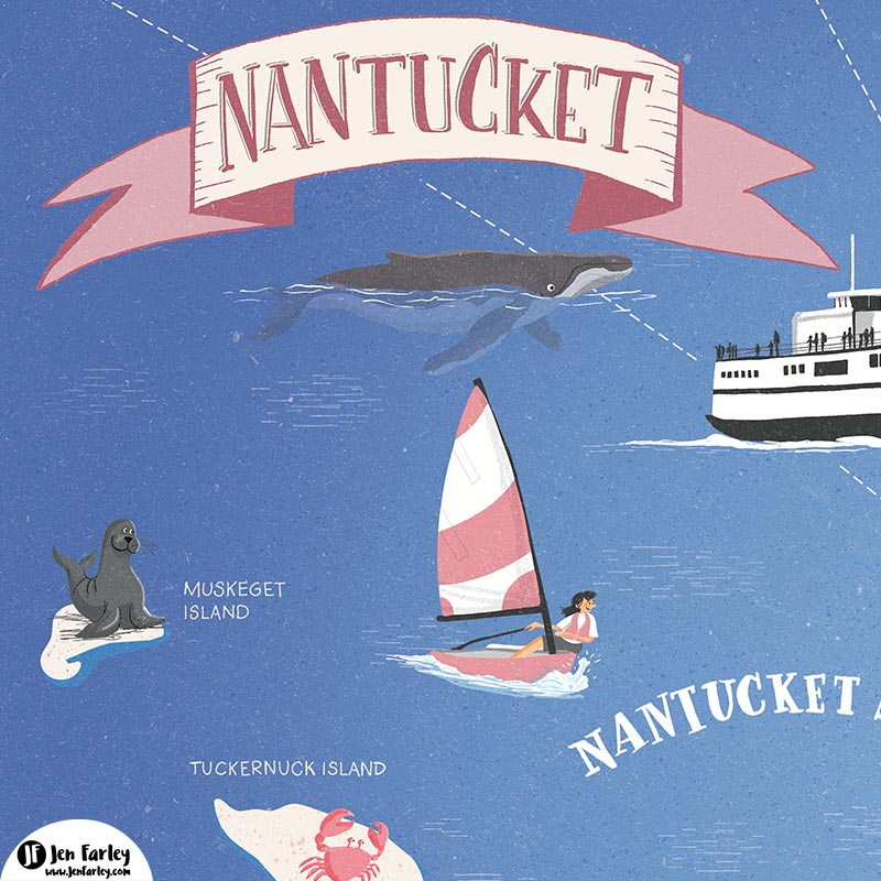
To celebrate its beauty, I’ve created a hand-drawn map that highlights the island’s most beloved spots, as well as the nearby islands of Muskaget and Tuckernuck.
Perfect for tourists, Nantucket enthusiasts, or island residents, this map offers a unique way to experience the island. You can buy your own print of the Nantucket illustrated map in my shop to enjoy at home or gift to a fellow Nantucket lover!
Nantucket – Heaven For Martitime Lovers
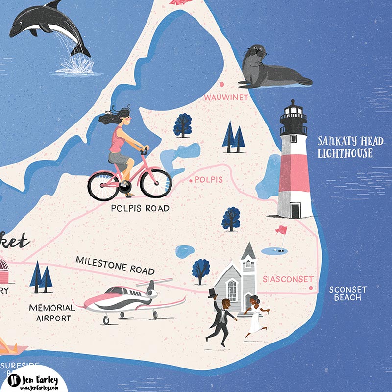
Nantucket is known for its rich maritime history, charming small-town feel, and gorgeous natural beauty. From the Grey Lady’s foggy mornings to the bustling harbor filled with boats, there’s no shortage of inspiring sights. It’s a place where past and present meet, and I wanted to capture that on this fun map, showcasing the key spots visitors and locals adore.
What’s on the Nantucket Illustrated Map?
Here’s a look at some of the main highlights that I’ve illustrated:
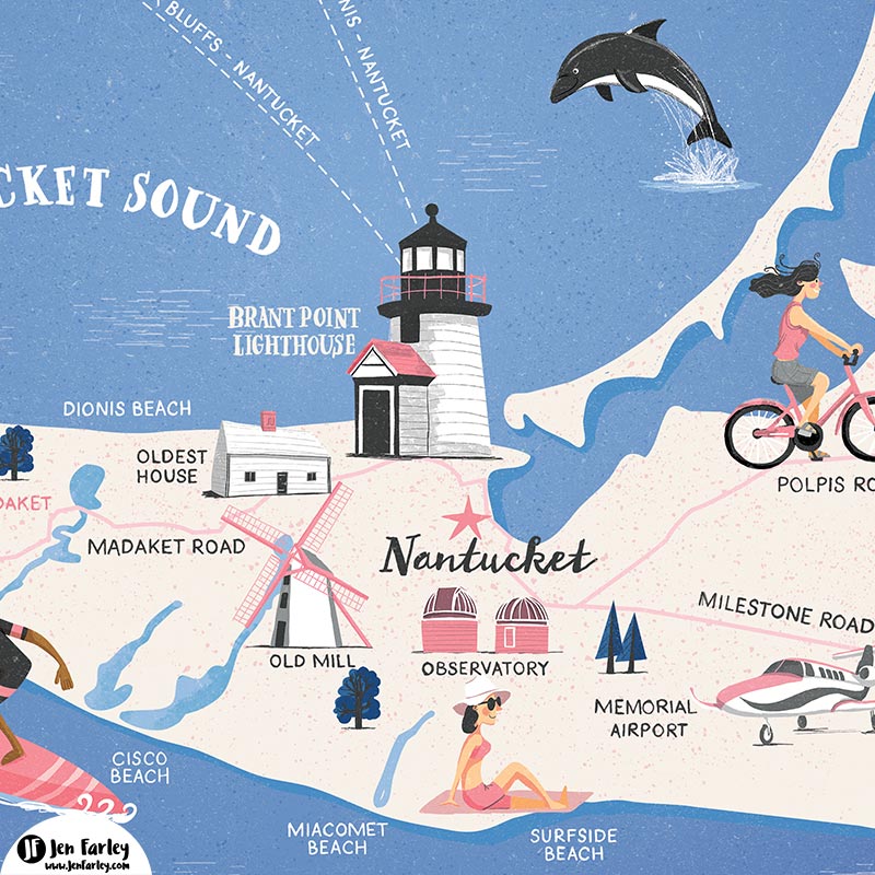
- Brant Point Lighthouse: A must-see for anyone visiting Nantucket, this historic lighthouse is one of the oldest in the U.S. and still guides ships into the harbor. You’ll find it prominently featured on my map.
- Sankaty Head Lighthouse: Located on the eastern end of the island in Siasconset, this iconic red-and-white lighthouse is a striking sight perched on the cliffs.
- Downtown Nantucket: Famous for its cobblestone streets and 19th-century architecture, downtown is a bustling hub filled with shops, restaurants, and galleries. It’s the heart of the island and a central focus of the illustration.
- Observatory: For stargazers, the Loines Observatory is an interesting visit. It offers incredible views of the night sky. I’ve included it on the map for the astronomy fans and anyone interested in Nantucket’s scientific side.
- Nantucket Nature Reserve: Nature lovers will appreciate the expansive conservation lands on the island. I’ve highlighted the Nantucket Nature Reserve, where you can experience the island’s wildlife and scenic beauty up close.
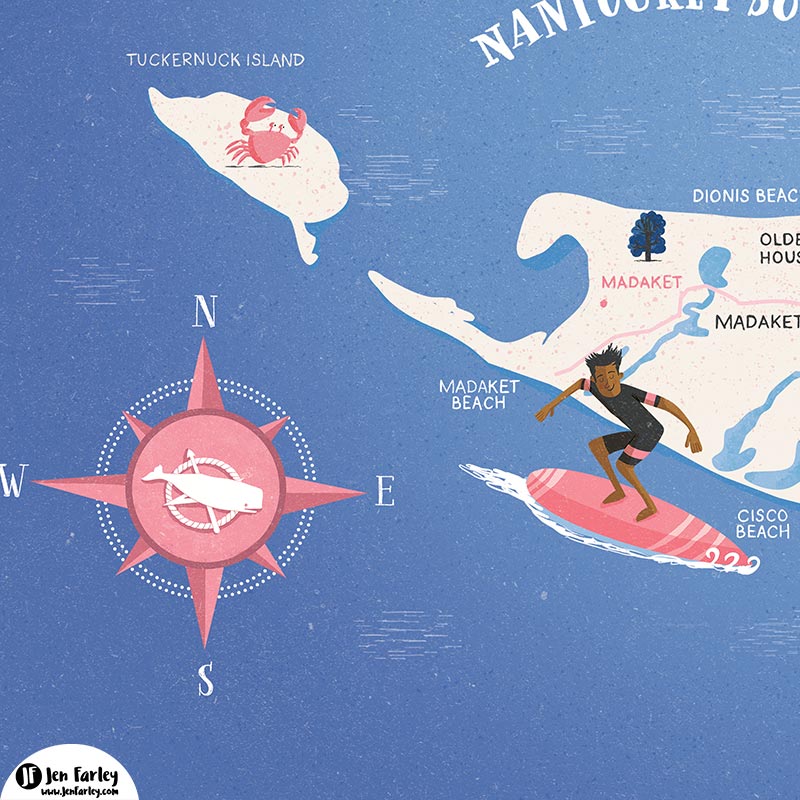
- Nantucket Beaches: From the popular Surfside Beach to the more secluded Madaket Beach, the island is surrounded by stunning shorelines. You’ll spot these coastal gems woven into the edges of the map.
- The Old Mill: Built in 1746, the Old Mill is the oldest functioning windmill in the U.S. and a significant part of Nantucket’s history. It’s an iconic landmark that still grinds corn to this day, and you’ll see it prominently marked on my map.
- The Oldest House: Also known as the Jethro Coffin House, this house was built in 1686. It is the oldest residence on Nantucket. It’s a beautiful representation of early island life, and I made sure to include it as a nod to the deep history that makes Nantucket so special.
- Tuckernuck and Muskaget Islands: Just off the coast of Nantucket, these two islands offer a quiet, untouched retreat from the main island. While they are less visited, they are known for their serene landscapes and wildlife.
Bringing The Nantucket Illustrated Map To Life
When creating this map, I wanted to capture both the charm and history of Nantucket while also including some fun details that reflect the island’s vibrant personality. Every element is carefully drawn by hand, from the lighthouses standing tall to the little boats sailing. The map is a blend of history, nature, and local flavour – perfect for hanging on your wall as a reminder of your favorite place.
Buy Your Own Nantucket Map
Whether you’re a frequent visitor, a proud islander, or just someone who loves unique artwork, this hand-drawn map makes the perfect keepsake. You can explore the landmarks of Nantucket and the nearby islands of Tuckernuck and Muskaget from your own home, plan your next trip, or share it with a friend who adores the island. Check out the map here and add a piece of Nantucket to your home decor!